Welcome to ‘My’ Park!
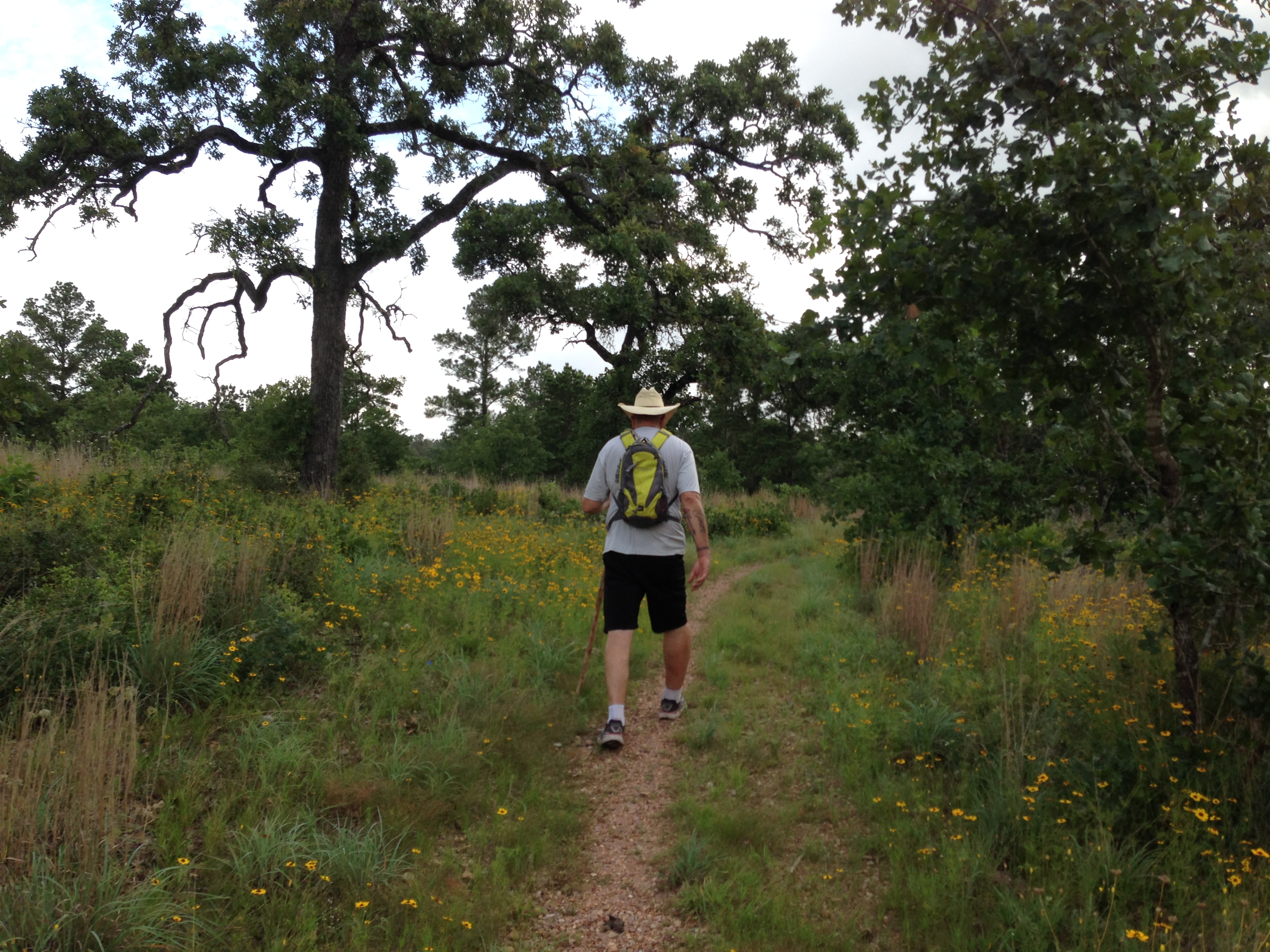
Am I the only one who thinks of their favorite trails with a possessive fondness ? When I go run or hike at the LCRA McKinney Roughs Nature Park in Cedar Creek, Texas, I feel like I am visiting my own little private place on the Colorado River. Yes, there might be other people there, but not that many, and I feel like they are just visiting my special place.
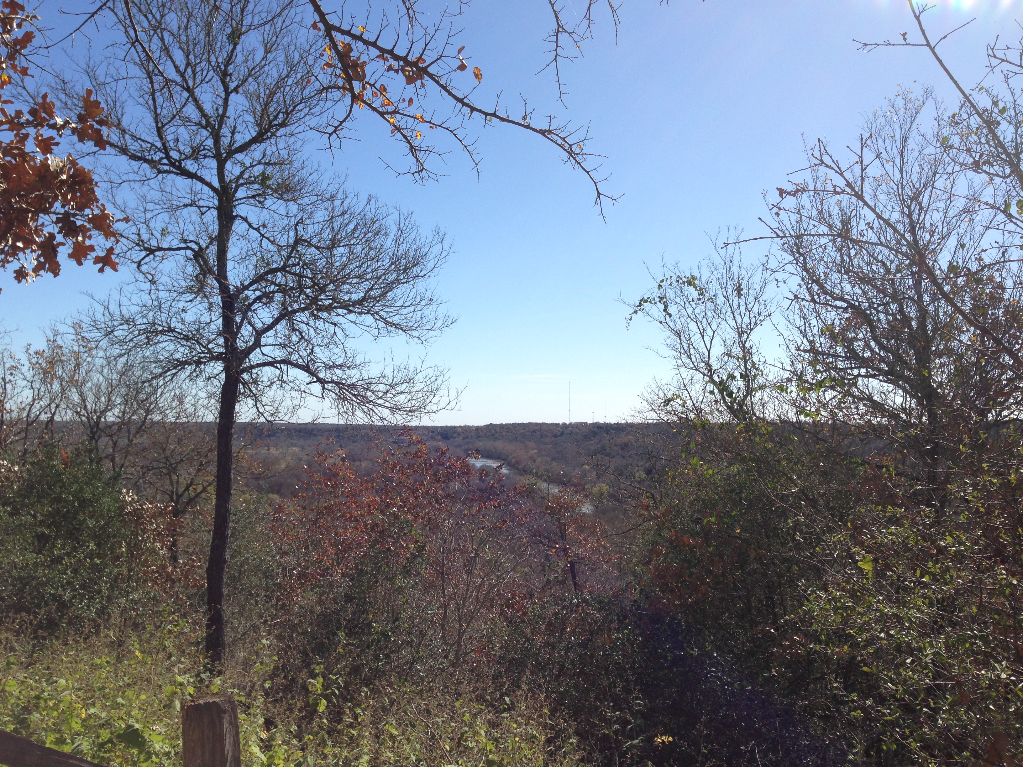
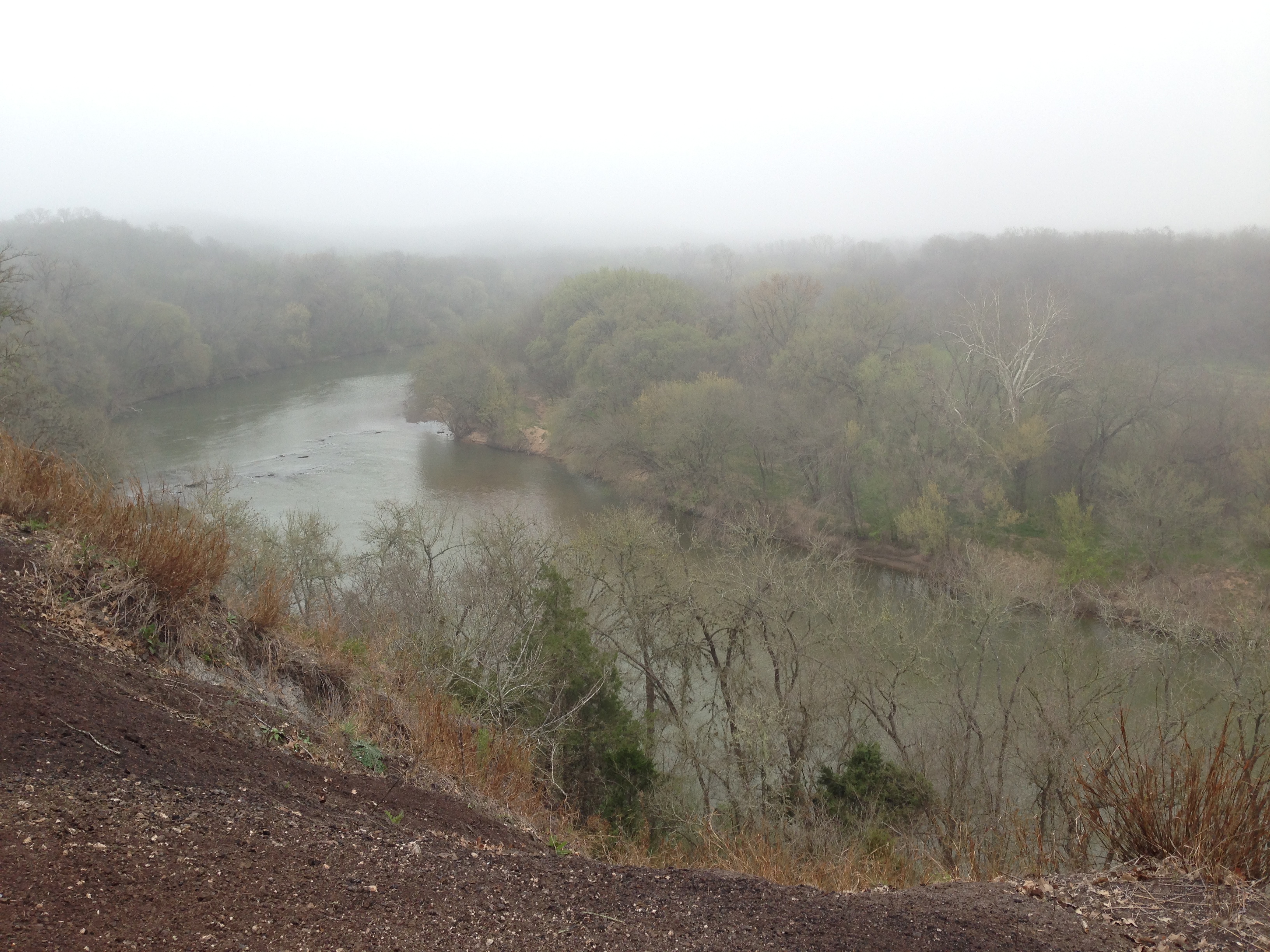
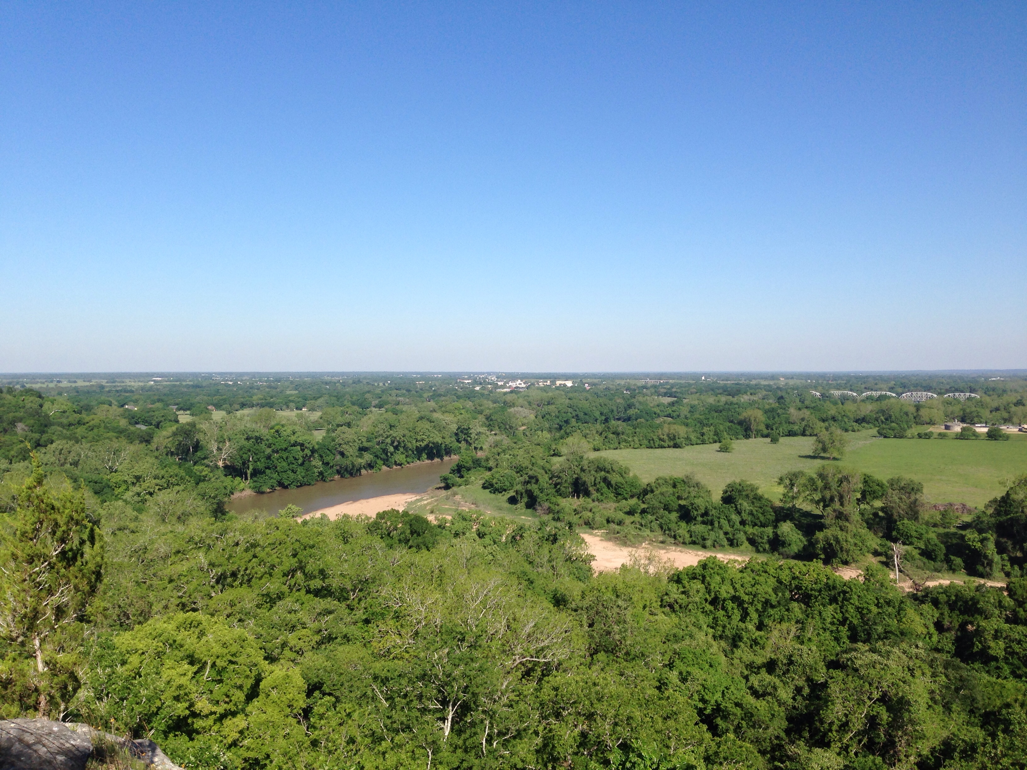
McKinney Roughs is not far from the hustle and bustle of Austin and Bastrop , yet when you are deep in the trees or down by the river, you feel like you are miles from civilization.
The park is also home to a zip line company and occasionally you will hear the sound of someone zipping over head. But mostly it’s very quiet except for the sounds of birds and the rustling of small (hopefully) animals in the brush along the trails.
The park is also home to a thriving community of spiders, snakes, and coyotes. If you are the first person on the trail, watch where you are going and have a stick ready to clear the countless webs, especially along the riverside trail, or you will be doing the spider dance .
On weekends you may encounter a few friendly horseback riders on certain trails or groups of hikers, couples and families.
But this park is not nearly as crowded as most state parks. The horses have never been a problem for me, however you may see some horse poop on the trails, along with coyote poop.
Don’t worry too much about wild animals, they stay hidden. This park is beautiful in all seasons.
If you are the first person on the trail, watch where you are going and have a stick ready to clear the countless webs, especially along the riverside trail, or you will be doing the spider dance .

A nice variety of trails
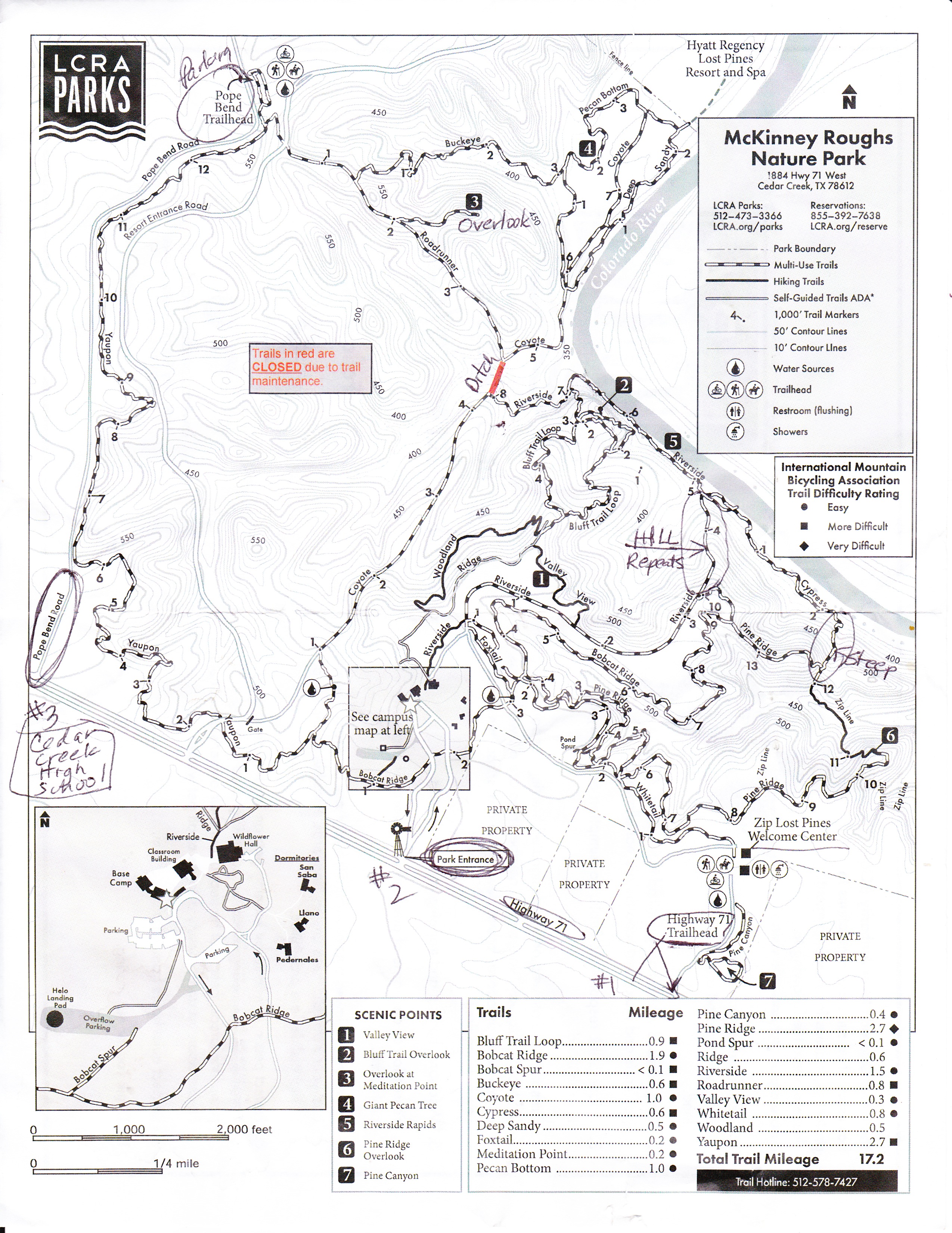
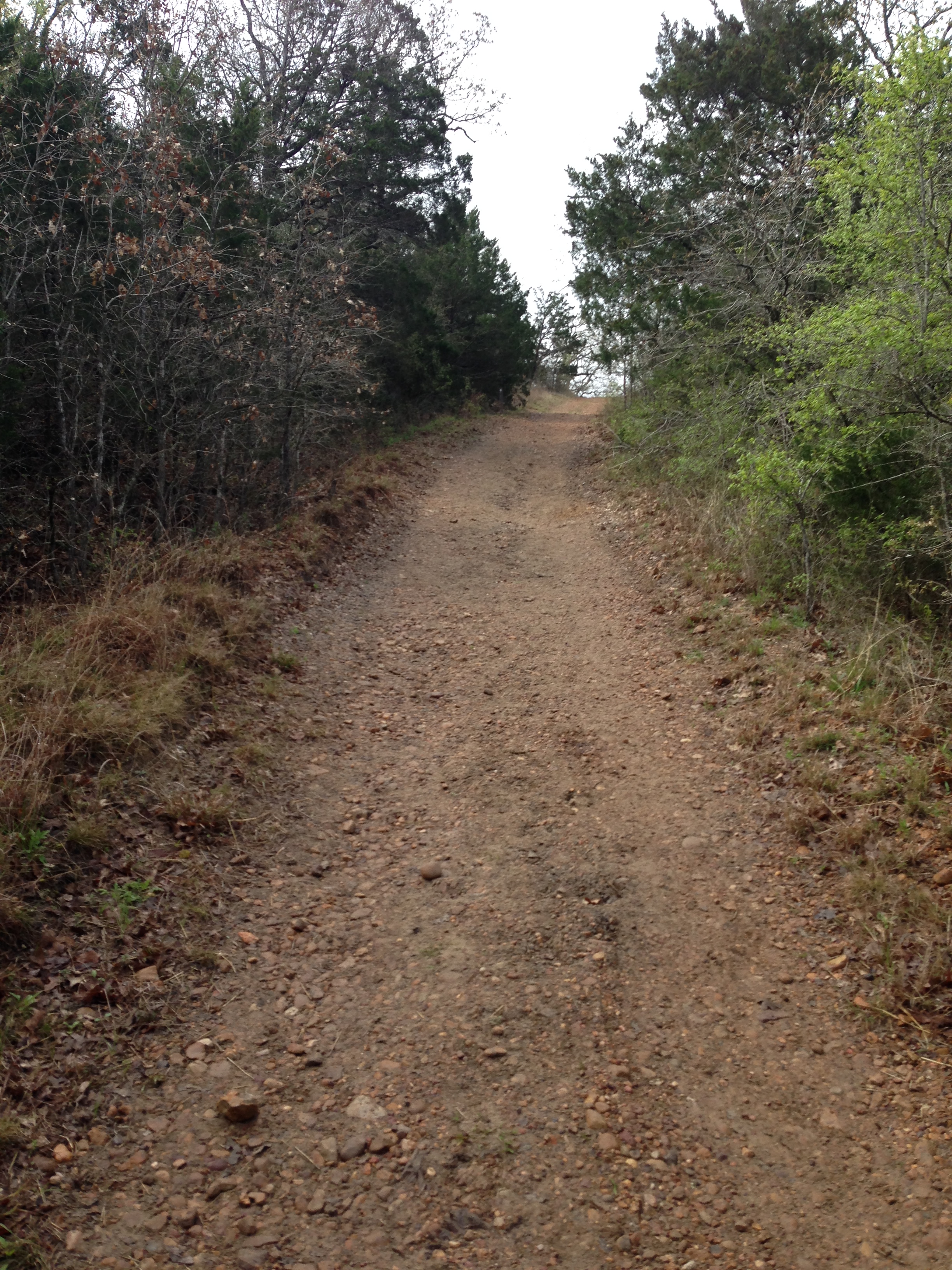
There are 17 miles of trails of various types including flat, hilly, shaded, sunny, rocky, regular dirt and red dirt, plus many kinds of trees and flowers.
Most of the trails are easy enough for all hiking abilities. But the Pine Ridge trail descent/climb ( past the #6 overlook) is a little more difficult and would not be good for someone who has difficulty with stairs.
The upper trails include some shade-giving pine and oak trees, some open flowery, grassy areas, and some sandy/gravelly sections. The lower trails below the cliff along the river are mostly flat and lush with tall green grass and tall trees.
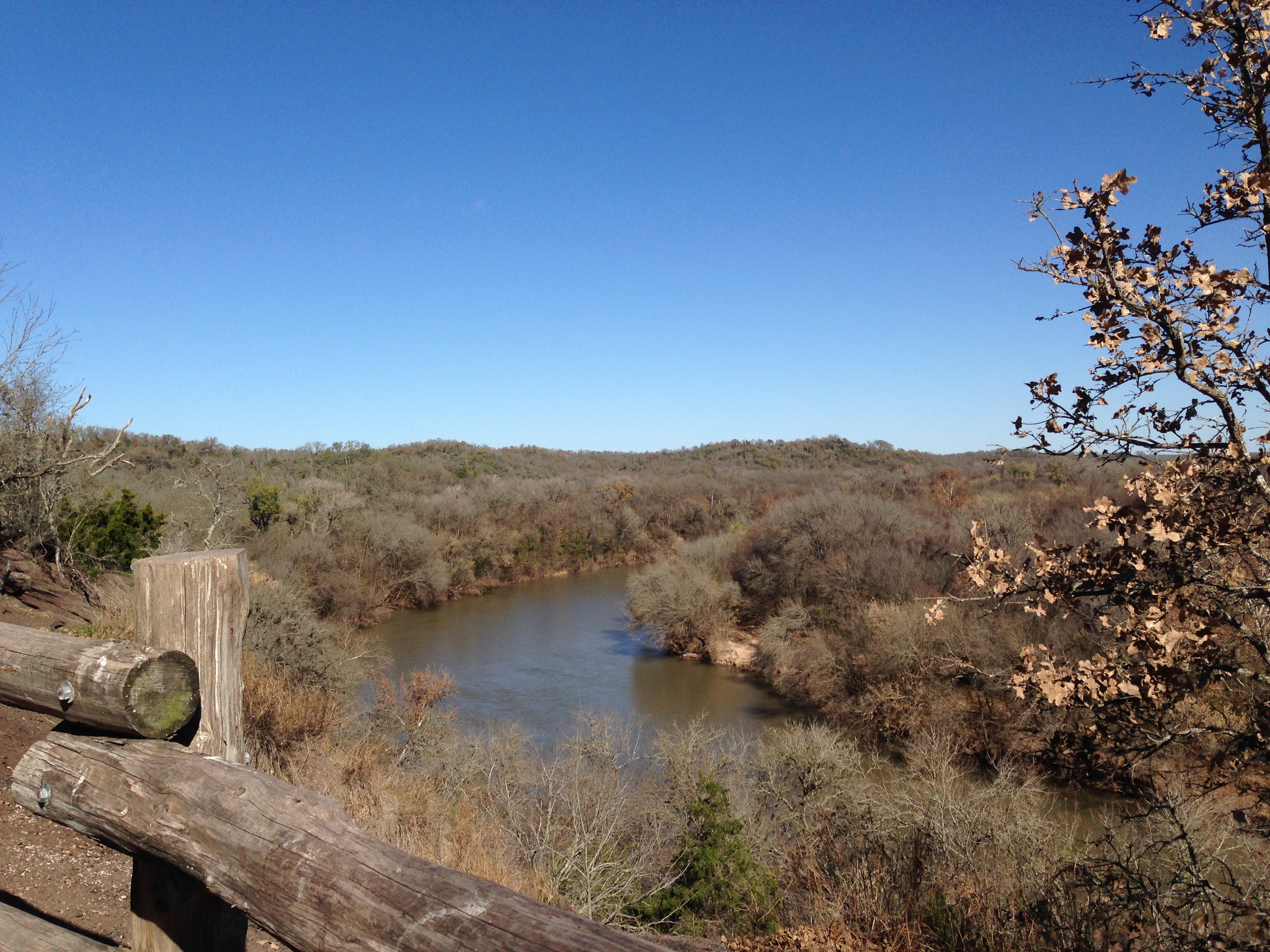
You can go right down to the river, but the current makes it unsafe for swimming. The elevation change from the upper to the river level is about 200 feet. For those who want to do hill repeats, there is a good hill for that on the Riverside trail.
One of my favorite short side trails is the Woodland trail which has a couple of switchbacks and offers a fun, slightly technical run down and then back up.
But the Pine Ridge trail descent/climb ( past the #6 overlook) is a little more difficult and would not be good for someone who has difficulty with stairs.
Parking Options
There are three options for parking depending on where you want to start your hike/run.
- The first one you meet coming from the east or Bastrop side of Texas Hwy 71, is the Zip Line parking lot, also called Highway 71 Trailhead. There is a self-pay box located at the trail head with maps where you can deposit the Day use fee of $5 ( cash) per person.
- The next entrance down is the main park entrance and has a brown park sign. After entering the park you will follow the road into the park and find the headquarters and other facilities there. You can pay at the office and there are bathrooms inside.
- The third option is a little further down Hwy 71 . Turn right (north) at the stop light with a sign that says Pope Bend Road and follow the road a few miles down to where you see a sign on the right that says Pope Bend Trail head parking.
- It’s easy to miss so be watching for it. The sign was partially hidden by a tree yesterday. There is a portable toilet and a Map on a board by the trail head, but no self-pay box or maps to take with you. Just take a photo of the sign, or stop by the office first and pay and get a map. This is also the horse trailer parking area.

#1 Starting your hike at Highway 71
I like to park here when I know I’ll want to take a shower after the run/hike. In the long summer months it gets very hot on these trails even in the shade and you will get sweaty!
The showers are located in the back of the bathroom building, but they may be locked. Ask in the zip line office for assistance.
When I want to run straight down to the river and then do either loops of Riverside/Cypress/Pine Ridge or hill repeats on Riverside, I park at Highway 71 because it’s the shortest route to those sections.
The map does not show it for some reason, but you can go straight across the road at the trailhead and then to the right on Pine Ridge which takes you to the zip line tower at Pine Ridge Overlook (6 on the map) .
Of course you can also take a left and go the other way around if you don’t want to go down to the river, and have to climb back up. Just a warning that the climb is steep.
I marked it on the map. Also it gets really hot in that little area in the heat of the day. Not much air moving, but it’s a short stretch of trail.

The river is beautiful in every season.
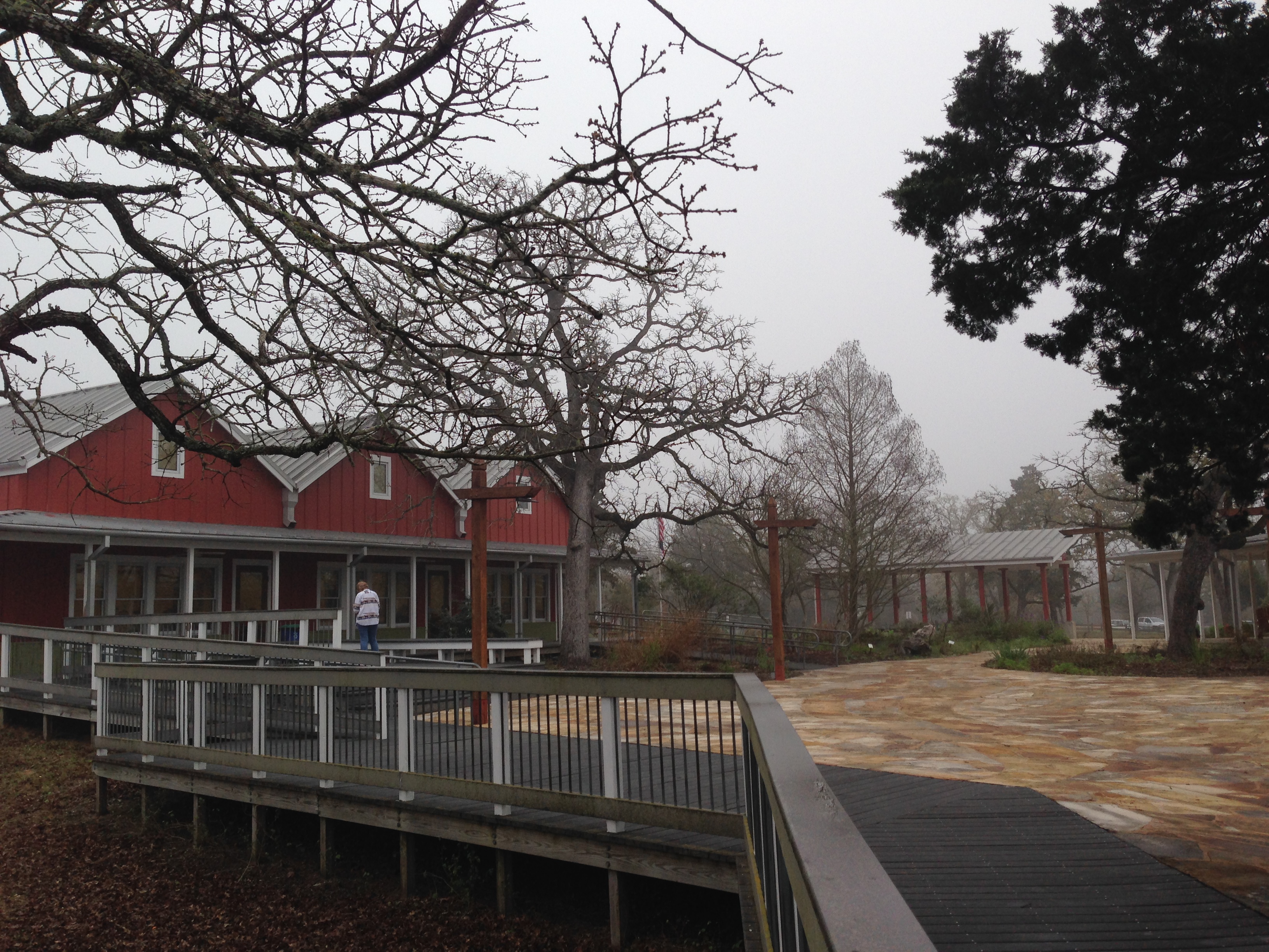
#2 Starting from Headquarters/Base camp (Star on map)
Most people start here on their first visit to the park.
After paying your fees in the office, you have several route choices. The easiest trail is the .6 mile Ridge trail that leads off to the left from the north side of the main courtyard area. This gravel path is flat enough for a stroller with big tires, but I don’t know about a wheelchair.
This way also leads you to the more difficult, but scenic, .5 mile Woodland Trail, and the .9 mile Bluff Trail Loop which can take you to a high and photogenic river overlook or down to connect to Riverside depending on which way you go.
Or you can continue onto Valley View to connect to the upper part of Riverside that will lead you on a flat gravel road and then down to the river.
Riverside is a total of 1.5 miles, but that includes the upper road section and the actual river section. If you make a right at Pine Ridge you’ll follow a roller coaster trail with nice views that goes to a zip line tower and the down to the river via a steep stair trail. Pine Ridge is a total of 2.7 miles including the upper and lower trails. Turn left to go down to the river or right to go back up to the top, so you can get some good steep climbing to the next zip line tower and a high scenic viewpoint.
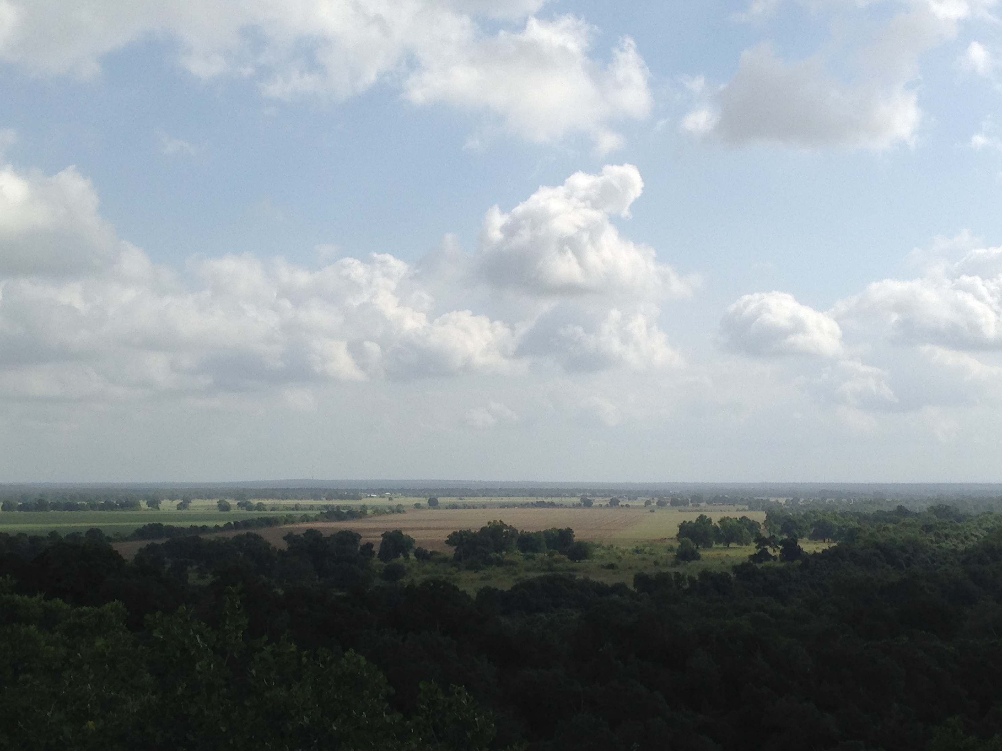
After reaching the scenic Pine Ridge Overlook, take a few photos, then stay on Pine Ridge and it will lead through some nice trees along the ridge and then out into a more open area where they have cut down all the cedar trees to allow it to go back to the natural grasses and flowers.
This trail cuts across a couple of other trails and is not well marked. Just keep going straight , unless you want to turn right and take Bobcat Ridge which I rarely do because it has a lot of deep gravel and sand, but it does have some shade.
Bobcat Ridge does offer more distance if you’re trying to add mileage; it is a loop that leads you all the way back around to Pine Ridge and then you’ll have to take to take unshaded part of upper Riverside back to the main parking lot so be prepared with enough water.


# 3 Starting your hike from Pope Bend Trailhead
Yaupon or Roadrunner?
The start of this section of the trail can be confusing so be sure you know which way you want to go. You are going to cross the road then you have to choose if you want to take Yaupon or Roadrunner.
I feel like the map is confusing for that section, so be watching for the signs.
If you go right at the fork , you are taking an approximately 4 mile loop (depending on if you go to Pecan Bottom which makes it more like 5.5 miles )and you will either have to go into the ditch (seen on the map as CLOSED) to get back to the parking area or turn around and go back the way you came.
Yaupon is nice, shaded and hilly, but you can hear highway noise and the trail is often either muddy or rutted from horses, as in hoof prints in dried mud.
Yaupon becomes Coyote Road if you continue the loop around this section and it includes a nice hill and is a nice trail when it’s dry, but avoid after a rain or your shoes will become big clods of mud.

Pecan Bottom trail
Roadrunner
If you take a left at the fork you will be on Roadrunner. This can make a nice loop of around 3 miles or more if you take extra trails.
You can either 1)take the first left at Buckeye for a roller coaster trail that leads down to a beautiful flat area called Pecan Bottom ( stay left) trail where you will see amazing giant old pecan trees or 2) continue on Roadrunner .
Pecan Bottom is very shady and quiet and leads to the Hyatt Regency Lost Pines Resort which is located on the river next to the park . I sometimes see resort visitors on the trails in that section. You can run all the way to the resort if you want.
The Deep Sandy is very nice when it’s open. I’ve seen a lot of deer in that section. Follow the trail and you have the option of continuing the loop, which will mean climbing back up since you went down to the bottom. Don’t miss the scenic overlook called Meditation Point. It is worth the climb.
If you stay straight on Roadrunner when you first hit the trail, instead of turning off at Buckeye, you will find the trail to Meditation Point shortly ahead on your left. Watch for it or you might miss the sign!
There is a picnic table at the overlook and a nice view of the river valley. Roadrunner is also a pretty good hill if you are looking for hill repeats.
If you want to continue your hike into the other sections of the park, you can follow the trail into the ditch. It’s a fairly steep climb down and up a wide ditch with some tricky footing and possibly get your shoes wet.
There used to be a fence there, but it has been taken down. The park seems to be okay with people doing this.
Roadrunner is also a pretty good hill if you are looking for hill repeats.
Water sources
The only drinkable water is available at the trail heads and one spigot on Yaupon near a horse tie-out, near the intersection with Bobcat Ridge. Please bring plenty of water. It gets hot and this is a big park.
And there is the river but I would only drink it if you filter it carefully. My dog happily drinks it! Also, but not guaranteed, there may be a cooler of water at the zip line towers, but it’s probably not meant for hikers.
Other facilities and contact info.
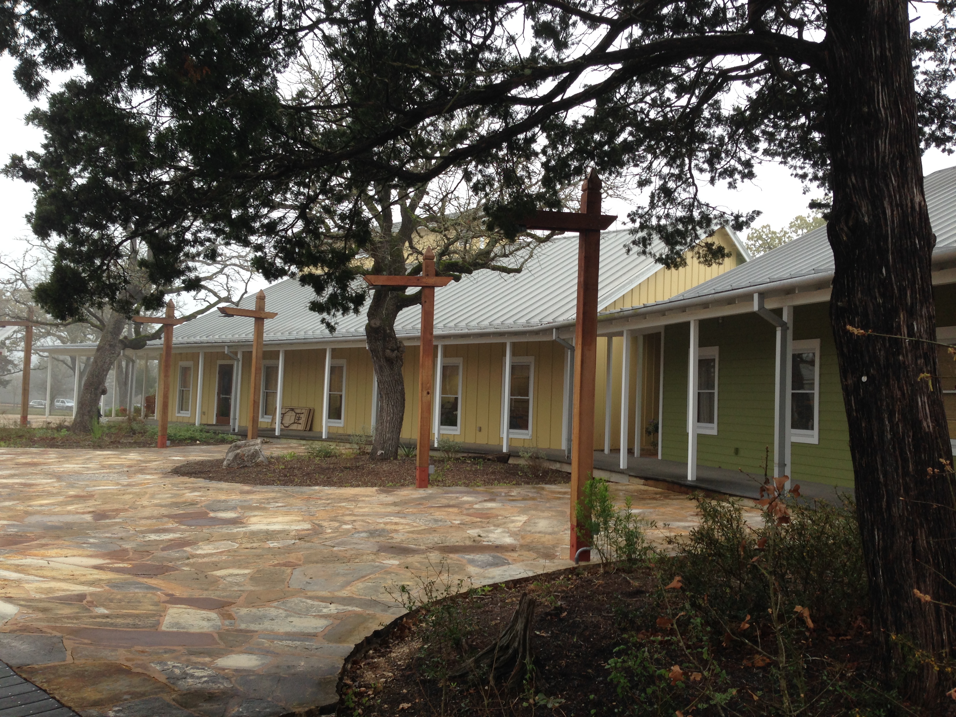
This 1,140 acre park offers a beautiful natural setting for special events such as weddings and meetings.
Facilities include an event hall, classroom building and several dormitories for group overnight stays. The main office contains a small nature display, bathrooms, maps and offers a small number of hiking items for sale.
The staff is always friendly and helpful. You can get more information about rentals or summer day camp for kids at the website McKinney Roughs Nature Park. You can also call the office at 512-303-5073 to check trail status. If it has rained a lot or for multiple days, the lower trails could be under water or too muddy to use.
McKinney Roughs is a true jewel and I really hope you will come and enjoy ‘my’ park. Let me know in the comment section or email me if you have any questions.
If you like hiking, you may be interested in checking out this book about the Lone Star Hiking Trail, the longest trail in Texas.

Affiliate Link


Interesting. I have never hiked at this place. I will check it out. It is on the other side of IhH35 from me and I tend to shun IH3.
Ha! I understand that . I rarely go into Austin anymore even though I used to live there and went to UT. The traffic is just too much. Maybe you can go early on a Sunday when everyone is sleeping. 😉
That is when I go downtown to take photos if I feel like it. I get to have the city to myself mostly.
I love McKinney Roughs, maybe because I did my first ever organized trail run there, aeons ago. Now I enjoy doing hill repeats on trail #6 from the top at the zip line station and down to the river and back, and repeat and repeat etc
I like that one too, but it can get pretty hot in that little closed in area.
[…] You can see more photos of this park in different seasons on my other posts about McKinney Roughs. Here’s the main guide . A guide to hiking […]
[…] You can find all the park details with trail descriptions and the map here. […]